


Troy University Athletics
Severe Weather Expected Saturday
4/23/2010 4:55:00 PM | Track & Field
ATLANTA, Ga. - A storm system moving through the Central U.S. will bring the threat of severe storms and heavy rain to the eastern half of the country through the weekend. Gusty winds are expected as well, including in areas that do not see storms.
The system could affect the sporting events taking place on the Troy University campus on Saturday. The Troy University track and field program is set to host the Coach O Invitational all day on Saturday and are currently in the process of making changes to the meet to have it concluded before the severe weather strikes. Meanwhile, the Troy University softball team is set to host a doubleheader with Louisiana-Lafayette that is set to air on CSS on Saturday. To stay-up-to-date on all weather-related issues with Troy University Athletics, check back with TroyTrojans.com.
In the event that there is severe weather in the area during the contests, here are the following guidelines to follow for your safety: If the Track/Soccer Facility is evacuated, all staff, participants, and fans will be directed to the ground floor of the Trojan Center. Everyone will remain in that location until the all clear is given. If the Softball Complex is evacuated, all Troy athletes and staff will be brought into the softball locker room. The visiting team will be brought to the honors house immediately behind the Softball Complex. All fans will be brought to the honors house closer to the lagoon. Everyone will remain in their designated location until the all clear is given.
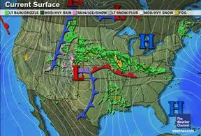
In the near term, severe weather is likely across Plains and Mississippi Valley. Severe storms expected to develop later on Friday in the Ark-La-Tex as well as further north in the Lower Missouri Valley. Damaging winds, large hail, and tornadoes are all possible with any storms that do become severe today. Heavy rain is also possible in these areas, as well as further north into South Dakota, extreme southern Minnesota, and much of Iowa, westward into the High Plains of Montana, Wyoming, and Colorado. On the cold side of the system, snow can be expected in the higher elevations of the Rockies in Colorado and Wyoming.
Severe storms should shift slowly to the east on Friday night, crossing the Mississippi River into western portions of Illinois, Kentucky, Tennessee, and much of Mississippi. The threat of severe storms will continue across much of Arkansas, Louisiana, Missouri, as well as southern Iowa and eastern Nebraska. Heavy rain can also be expected in these areas as well as in the High Plains and Upper Mississippi Valley. Once again, any storms that do become severe will be capable of producing damaging winds, large hail, and tornadoes. A significant number of tornadoes are possible. Some tornadoes may be large and have a long track.
The severe weather and heavy rain threat will spread across the Southeast over the weekend, with severe storms possible in the Ohio and Tennessee Valleys on Saturday. An outbreak of tornadoes is possible across the Deep South Saturday spreading across the Southeast Saturday night into Sunday. Damaging winds and large hail are also possible with any severe storms over the weekend. Heavy rain is possible across the Midwest Saturday, spreading into the Mid-Atlantic Saturday night and Sunday.
Through Saturday night, rainfall amounts over one inch can be expected in much of the Southeast, the Ohio Valley, parts of the Mid-Mississippi Valley, and into the Plains. Local amounts over two inches are possible in these areas. Snowfall amounts in the Rockies should exceed six inches in some areas, primarily in the higher elevations of Colorado and southern Wyoming.
Stay tuned to The Weather Channel and log onto weather.com for updates on the storm.


